SURVEYS & SETTING OUT

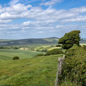
TOPOGRAPHICAL SURVEYS
TOPOGRAPHICAL SURVEYS
TOPOGRAPHICAL SURVEYS
Our topographical surveys provide accurate measurements of land features, boundaries, and existing structures. Using the latest surveying technology, we deliver detailed site plans that form a reliable foundation for design, planning, and construction. Whether for small residential plots or large-scale developments, our surveys ensure you have the precise data needed to make informed decisions.

BATHYMETRIC SURVEYS
TOPOGRAPHICAL SURVEYS
TOPOGRAPHICAL SURVEYS
We provide high-accuracy bathymetric surveys to map and measure underwater terrain, depths, and features. Using advanced sonar and GPS technology, our surveys deliver detailed data for ports, rivers, lakes, reservoirs, and coastal projects. This information supports safe navigation, dredging, environmental monitoring, and marine construction planning

ON SITE SETTING OUT
TOPOGRAPHICAL SURVEYS
ON SITE SETTING OUT
Our site setting out services translate your design plans into precise on-site positions, ensuring construction is built accurately to specification. Using the latest surveying equipment, we mark foundations, structures, roads, and utilities with exact measurements, giving contractors the confidence to build efficiently and correctly from the ground up.

3D LASER SCANNING
3D LASER SCANNING
ON SITE SETTING OUT
Our 3D laser scanning services capture highly accurate, detailed data of buildings, structures, and landscapes. Using advanced scanning technology, we produce precise 3D models and point clouds that support design, refurbishment, clash detection, and as-built records. This delivers reliable digital information for architects, engineers, and contractors.

DRONE SURVEYS
3D LASER SCANNING
DRONE SURVEYS
Our drone survey services provide fast, safe, and cost-effective aerial data collection. Using high-resolution imagery and LiDAR technology, we capture detailed site information for mapping, inspections, progress monitoring, and volumetric analysis. This allows accurate results to be delivered quickly, even across large or hard-to-reach areas.

MONITORING
3D LASER SCANNING
DRONE SURVEYS
We provide precise monitoring surveys to track movement, settlement, or deformation of structures and land over time. Using advanced surveying technology, we deliver accurate data that helps identify risks early and ensures safety and compliance throughout construction or long-term asset management.

PERCOLATION TESTING
Cut / Fill & Surface Modelling
PERCOLATION TESTING
Our porosity testing services accurately assess the permeability of ground and construction materials. By measuring how water or air passes through soils, concrete, or stone, we provide essential data for drainage design, ground investigations, and quality control, ensuring long-term stability and performance.
LAND BOUNDARIES
Cut / Fill & Surface Modelling
PERCOLATION TESTING
We provide expert boundary dispute surveys to clearly establish property lines and resolve ownership uncertainties. Using accurate measurements and historical land records, we deliver impartial reports and plans that support legal proceedings, mediation, or neighbour agreements with reliable evidence.

Cut / Fill & Surface Modelling
Cut / Fill & Surface Modelling
Cut / Fill & Surface Modelling
We create detailed Digital Terrain Models (DTMs) and surface models to accurately represent land contours and features. Using advanced surveying and modeling technology, we provide precise data for design, planning, volume calculations, and construction, helping projects run smoothly from concept to completion.